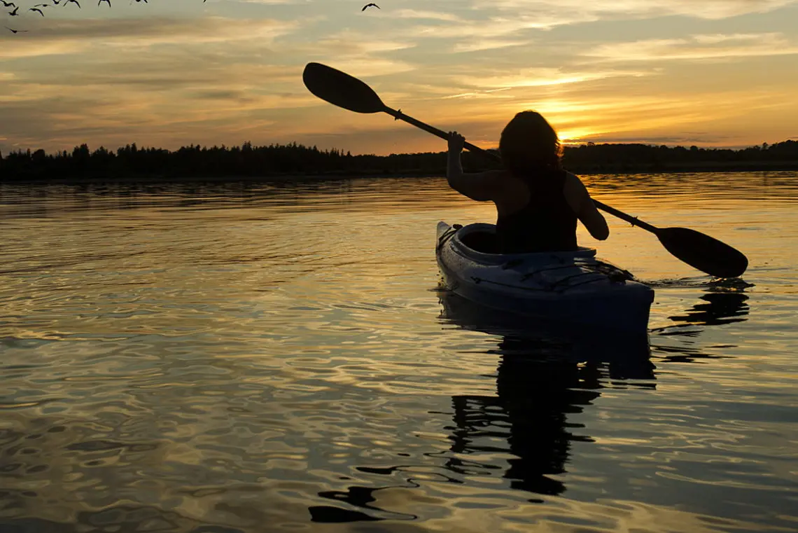
Visitors who crave a kayaking adventure will fall in love with New Bern. This Inner Banks destination at the heart of the “Twin Rivers” region boasts access to more than 250 miles of mapped paddling trails as well as more than 30 launch sites throughout Craven County. As a result, paddlers from beginner to expert levels will find endless room to roam, from the downtown area to the wilds of the nearby Croatan National Forest.
New Bern Paddling Trails
New Bern borders two major rivers – the Neuse and the Trent Rivers – and is also home to a wide range of larger creeks, such as Brices Creek, Upper Broad Creek, and Slocum Creek. This network of waterways ensures paddling trails of all varieties, from wide slow-moving river waters to narrow and more challenging trails.
Kayakers who want to discover all their options will find several resources available through local organizations like the Twin Rivers Paddle Club, Craven County Parks and Rec, and the Croatan National Forest. With that being said, there are a number of highly publicized trails that paddlers may want to consider as a destination for a wild and far-reaching adventure.
Contentnea Creel - Neuse River
Paddle distance: 10.8 miles
Put-in: Grifton NCWRC (N35 22.075 W77 25.987)
Take-out: Maple Cypress Bridge (N35 18.762 W77 18.106)
Trip Highlights: Trail has creek and river components, as well as forests and cypress swamps. Excellent bird and wildlife watching.
Trip Difficulty: Moderate to difficult because of the distance
Hazards: Maritime traffic, winds, and slight currents
Upper Neuse River
Paddle distance: 11.2 miles
Put-in: Maple Cypress Bridge (N35 18.762 W77 18.106)
Take-out: Cowpen Landing (N35 14.303 W77 10.032)
Trip Highlights: River trail that veers through forests and cypress swamps. Excellent bird and wildlife watching.
Trip Difficulty: Moderate to difficult because of the distance
Hazards: Maritime traffic, slight currents, and possible winds
Middle Neuse River
Paddle distance: 10.6 miles.
Put-in: Cowpen Landing (N35 14.303 W77 10.032).
Take-out: Glenburnie Park (N35 08.378 W77 03.595).
Trip Highlights: River trail that veers through forests, cypress swamps, and marshes. Excellent bird and wildlife watching.
Trip Difficulty: Moderate to difficult because of the distance and some open water.
Hazards: Maritime traffic, slight currents, and possible winds.
Glenburnie Park Circle
Paddle distance: 5.3 miles or 9.6 miles w/ added loop Neuse River.
Put-in: Glenburnie Park Ramp (N35 08.378 W077 03.595).
Option: Bridgeton NCWRC Ramp (N35 08.660 W77 2.880).
Trip Highlights: Open river trail with marsh islands en route. Excellent bird and wildlife watching.
Trip Difficulty: Moderate because of the distance and some open water.
Hazards: Maritime traffic, wind, waves and some open water conditions.
Turkey Quarter Creek
Paddle distance: 8.6 miles via Greens Thoroughfare.
Put-in: Pitch Kettle Landing (N35 16.969 W77 15.528.
Take-out: Cowpen Landing (N35 14.303 W77 10.032).
Trip Highlights: River trail that veers through forests, cypress swamps and marshes. Excellent bird and wildlife watching.
Trip Difficulty: Moderate because of the distance and some open water.
Hazards: Maritime traffic, slight currents, and possible winds.
Swift Creek
This total trail is 16.4 miles long, but paddlers can launch into three separate sections which are as follows:
1st Section: Vanceboro (N35 13.706 W77 08.896) to the Hwy 43 Bridge (N35 13.893 W77 06.738) (6.2 miles).
2nd Section: Hwy 43 Bridge (N35 13.893 W77 06.738) to Cool Springs Landing (N35 11.588 W77 05.017) (4 miles).
3rd Section: Cool Springs Landing (N35 11.588 W77 05.017) to Bridgeton NCWRC Ramp (N35 08.760 W77 2.880) (6.2 miles).
Trip Highlights: A variety of environments including swamp, river, maritime forest and open river. Diverse birdwatching and wildlife watching.
Trip Difficulty: Difficult to Easy depending on the distance with some open water/wind conditions throughout.
Hazards: Maritime traffic, wind, snakes, and the possibility of getting lost.
Bachelor Creek
Paddle distance: roughly 8.5 miles.
Put-in: Hwy 43/Bachelor Creek Bridge (N35 10.688 W077 07.883).
Take-out: Glenburnie Park Ramp (N35 08.378 W077 03.595).
Trip Highlights: Diverse landscape that starts as a creek and becomes marshlands and open river. Excellent bird and wildlife watching.
Trip Difficulty: Moderate to difficult because of the distance and some open water.
Hazards: Maritime traffic, wind, slight current, snakes and reptiles.
The Gut
Paddle distance: 8.9 miles.
Put-in: Spring Garden Landing (N35 13.140 W077 08.899).
Take-out: Glenburnie Park Ramp (N35 08.378 W077 03.595).
Trip Highlights: Diverse trail with rivers and creek terrain, cypress swamps, and marshes.
Trip Difficulty: Moderate because of the distance, the currents, and some open water.
Hazards: Maritime traffic, wind, slight current, snakes and reptiles
New Bern Circle
Paddle distance: 6.6 Miles or 7.6 Miles.
Put-in: Union Point Park Ramp (N35 06.245 W77 02.065).
Optional Put-in: Lawson Creek Park (N35 05.956 W077 02.900).
Trip Highlights: Open river terrain with excellent views of the city
Trip Difficulty: Moderate due to open water and the distance.
Hazards: Maritime traffic, wind, and possible waves.
Lawson Creek Park Circle
Paddle distance: 8.5 Miles.
Put-in: Lawson Creek Park Ramp (On Creek N35 06.056 W77 03.051).
Optional Put-in: Lawson Creek Park Ramp (On River N35 05.956 W077 02.900).
Trip Highlights: Terrain includes river and back waters, with both populated and more natural, wild regions.
Trip Difficulty: Easy to Moderate due to open water and distance.
Hazards: Maritime traffic, wind, possible waves, and a slight current.
Trent River Circle
Paddle distance: 8.6 Miles
Put-in: Trent Woods Drive Bridge (N35 04.700 W077 06.250)
Trip Highlights: River terrain that borders a populated residential area.
Trip Difficulty: Moderate due to open water and the distance.
Hazards: Maritime traffic, slight currents, and possible winds.
Brices Creek
The Brices Creek Trail has a total distance of 12 miles, but can be divided into multiple sections which are outlined as follows:
1st Section: SR 1111 Bridge (N35 00.540 W77 01.608) to Brices Creek NCWRC Ramp (5 miles)
2nd Section: Brices Creek NCWRC Ramp (N35 02.965 W77 02.904) to Merchant Store (4 Miles)
3rd Section: The Merchant's Store (N35 03.986 W77 04.246) to Lawson's Park Ramp. (N35 05.956 W77 02.899) (3 Miles)
Trip Highlight: Trail comprises of a meandering creek which eventually connects with open river waters. Excellent bird and wildlife watching.
Trip Difficulty: Moderate to difficult based on the distance and varying terrain.
Hazards: Maritime traffic, wind, slight current, snakes and reptiles
Brices Lakes Circle
Paddle distance: About 4 miles
Put-in: Merchants Store Ramp (N35 03.986 W077 04.246).
Trip Highlights: Trail includes creek and lakes in slightly residential area. Excellent bird and wildlife watching.
Trip Difficulty: Easy to Moderate because of the distance.
Hazards: Maritime traffic, slight currents, and possible winds.
Upper Broad Creek Circle
Paddle distance: 7.0 miles
Put-in: Lee's Landing NCWRC (N35 06.395 W76 56.045)
Trip Highlights: Trail features a creek setting with marshes, forests, and cypress swamps. Decent bird and wildlife watching throughout.
Trip Difficulty: Easy to Moderate with narrow waters along the way
Hazards: Submerged stumps, snakes and reptiles
Upper Broad Creek - NW Harbour
Paddle distance: 6 to 10 miles.
Put-in: Lee's Landing (N35 06.395 W76 56.045)
Take-out: Fairfield Harbour (N35 03.981 W76 58.079)
Trip Highlights: Creek and river terrain with some nearby development. Decent bird and wildlife watching.
Trip Difficulty: Moderate to difficult because of the distance and some open water.
Hazards: Maritime traffic, slight currents, and possible winds.
Neuse River "North Shore"
Paddle distance: 10 to 13miles
Put-in: Bridgeton NCWRC Ramp (N35 08.660 W77 02.880)
Alt. Take-out: Fairfield Harbour (N35 03.981 W76 58.079)
Alt. Take-out: Lee's Landing NCWRC (N35 06.395 W76 56.045)
Trip Highlights: Creek and river terrain with decent bird and wildlife watching
Trip Difficulty: Difficult because of the distance and open water conditions.
Hazards: Maritime traffic, winds, and open water.
Neuse River "South Shore"
Paddle distance: 18.5 miles
Put-in: Union Point Park Ramp (N35 06.254 W77 02.070)
Take-out: Hancock Creek NCWRC (N34 55.022 W76 51.173)
Trip Highlights: River frontage and creeks, with decent bird and wildlife watching.
Trip Difficulty: Very difficult because of the distance and open water conditions.
Hazards: Maritime traffic, probability of high winds and / or waves, and open water.
Slocum Creek Circle
Paddle distance: 12 miles
Put-in: Slocum Creek NCWRC (N34 53.460 W76 55.420)
Trip Highlights: Narrow streams and creek terrain. Excellent bird and wildlife watching.
Trip Difficulty: Moderate to Difficult because of the distance and open water
Hazards: Maritime traffic, probability of high winds, and open water conditions.
New Bern Kayak Rentals and Shops
Visitors who don’t have a kayak handy will find several options for renting or purchasing their own vessel in order to explore the abundant waters.
There are roughly a half dozen watersports stores in and around the New Bern region, which includes several that are geared directly towards paddlers – such as Merchant's (Canoe Rentals) and Bear Town Adventure Co. In addition, there are several local tour companies found in the heart of Downtown New Bern that specialize in guided explorations of the surrounding region.
For more information, visitors can explore the options in the heart of the downtown, and / or stop by the Visitors Centers for pamphlets and guidance on local paddling tour providers and kayak vendors.
New Bern Kayaking Tips and Considerations
- New Bern is a great destination for kayak fishing. Several local tour companies and / or inshore charter fishing businesses can cater to paddlers, and visitors can get info on local hot spots for kayak fishing at area bait and tackle shops.
- Come prepared for Inner Banks paddling. Water, bug spray, and sturdy water shoes will all come in handy for navigating the terrain, especially in the hot and buggy summer months.
- Visitors can often get deals on used kayaks and equipment after the summertime tourist rush is over. Stop by local kayak sales and rental establishments in the mid to late fall months for kayaking gear at a bargain.
- Paddlers staying in the downtown area won’t have to travel too far to find a close launching point. Union Point Park and Lawson Creek Park – both in the heart of New Bern’s downtown – have several boat launches that can easily be utilized by kayaks and canoes.
- Be careful when paddling in the heat of New Bern. Vessels of all sizes frequent these waters, so the chance of maritime traffic is high.
- Extend a kayaking adventure with a camping trip. New Bern is home to several camping destinations within or close to the Croatan National Forest which makes a kayaking vacation a budget-friendly breeze. Best of all, a number of these destinations are riverfront or creekfront, proving ample paddling access.
From picturesque downtown settings to miles of river and creek waters, the New Bern kayaking scene is as extensive as it is diverse. Enjoy a wild paddle through miles of unique waterways, and discover how the “Twin Rivers” region earned its name.

Take a quick and scenic ferry ride with your experienced guide over to the pristine Outer Banks Island of Shackleford Banks, which is part of the Cape Lookout National Seashore. There, you are introduced to the wild horses of Shackleford...

Founded as the world's first hang gliding school in 1974, Kitty Hawk Kites has grown into a beloved retail and outdoor recreation venture with more than 28 locations up and down the east coast! With more than 50 years of teaching the world to fly...
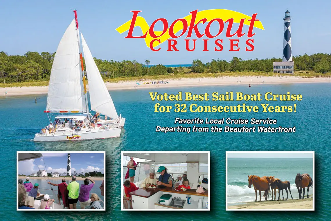
Visitors can enjoy the Crystal Coast’s most coveted and hard-to-reach shorelines, or just embark on a breezy cruise of the open waters in search of dolphins and sunsets, with a trip that’s guided by Lookout Cruises. This local tour...
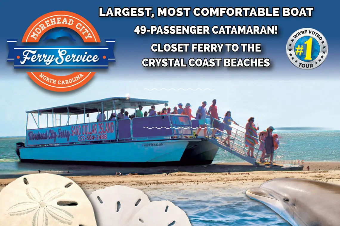
The Crystal Coast is best explored from the water, and Morehead City Ferry Service will take explorers to some of the most remote and beautiful corners of this long stretch of Southern Outer Banks shoreline. Launching from the heart of Downtown...
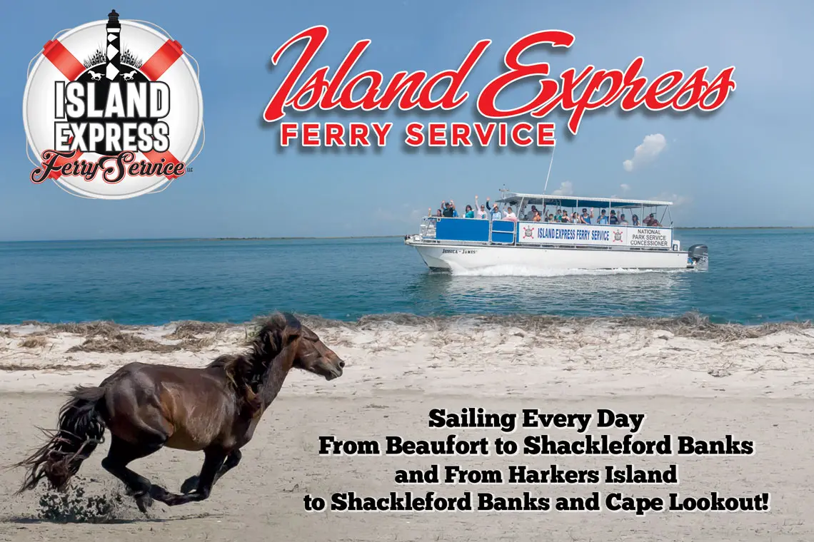
Island Express Ferry Service LLC is the only authorized concessionaire to drop off at Cape Lookout Lighthouse and Shackleford Banks! Offering departures from both Beaufort and nearby Harkers Island, Island Express Ferry Service serves as the...